Wildfire ecohydrology in the Zambezi River Basin
Published collaborative research connecting wildfire activity, environmental history, and ecosystem response.
PublishedProblem
Wildfire does not happen in isolation. Our research examined how surface conditions, preceding hydroclimate, and post-fire vegetation and water response connect across the Zambezi River Basin.
Approach How I thought about it
- Our study connected short-horizon surface conditions, antecedent hydroclimate, and post-fire vegetation and water response in one analysis.
- The methods included regression, distributed-lag analysis, random-forest validation, and sub-basin robustness testing.
What I built or did
- I supported conceptual development, environmental data curation, interpretation, and manuscript development.
- The collaborative study integrated 263 months of Earth-observation data across the Zambezi River Basin.
Results
- Published
Coauthored a peer-reviewed paper in Remote Sensing, 18(17), 3009 (2026).
Tools
- Python
- Google Earth Engine
- GIS
- MODIS
- CHIRPS
- ERA5-Land
- Environmental time-series analysis
Publication
Lutz, H.; Uthlaut, G.; Kim, K.; Lakshmi, V. (2026). Surface Thermal State, Antecedent Hydroclimate, and Post-Fire Vegetation–Water Response in the Zambezi River Basin: A Multi-Source Environmental Time-Series Analysis. Remote Sensing, 18(17), 3009 (2026)
Links
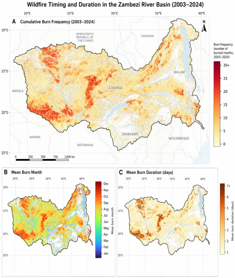
Zambezi River Basin fire characteristics for 2003 to 2024: cumulative burn frequency, mean burn month, and mean burn duration.
Figure 1 from Lutz et al. (2026), CC BY 4.0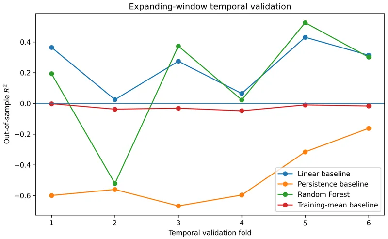
Expanding-window temporal validation of burned-area models: the Random Forest compared with linear, persistence, and training-mean baselines on strictly future holdout blocks.
Figure 2 from Lutz et al. (2026), CC BY 4.0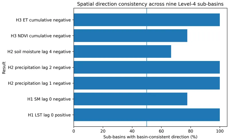
Direction consistency of the primary H1 to H3 results across nine Level-4 HydroBASINS sub-basins.
Figure 7 from Lutz et al. (2026), CC BY 4.0